Update: ACUASI was able to successfully survey a 3.87 mile stretch of Alaskan pipeline using DAA technology while also BVLOS on July 31, 2019 . This is the first waiver approved by the FAA for DAA and BVLOS without the use of a visual observer. Progress.
On July 17, 2019 Sky Horse Tech editor Michael DuFour was able to visit the University of Alaska Fairbanks campus. This university has a rich history of scientific research, including its flagship Geophysical Institute (GI) which was created by an Act of Congress in 1946. In 2019 this research facility celebrated its 50 year anniversary of developing and using rockets to study the Earth’s electric field in the lower ionosphere. Their researchers have launched more than 1,000 rockets since then. In the years that followed, the GI has studied everything from the vast Alaskan pipeline to the impacts of climate change in the Arctic.
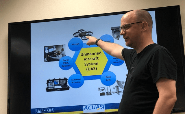
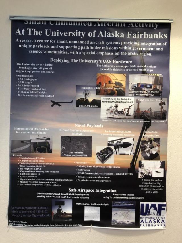
In 2012, UAF created the Alaska Center for Unmanned Aircraft Systems Integration (ACUASI)after realizing the potential uses of UAS. Per the ACUASI website:
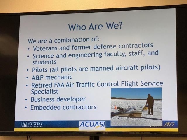
It was established under the University of Alaska Fairbanks in the Geophysical Institute where it originated but was given the role of leading all unmanned aircraft programs for the entire system. It was also tasked to pursue opportunities with the FAA such as the FAA test sites. The program originated in 2001, and over the years has expanded in scope, the equipment it operated, and the variety and complexity of research projects it executed. In 2013 ACUASI submitted its proposal to the FAA to become one of the six test sites established by the 2012 FAA Modernization and Reform Act, and in December 2013 the FAA announced that the University had been selected. The Pan-Pacific UAS Test Range Complex reports to ACUASI, but also includes principal partners in Oregon and Hawaii as well as 56 non-state partners located all over the US and internationally. Ranges are located in the three states as well as in Iceland, our key international partner.
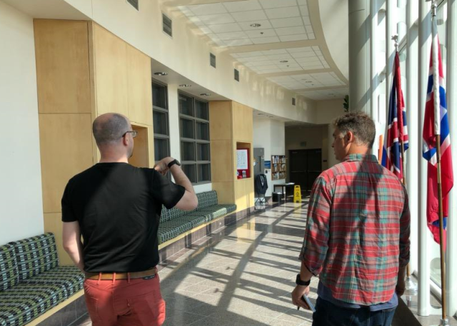
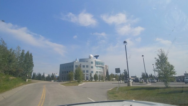
We met with Dr. Peter Webley, Associate Director of Research at ACUASI, who spoke with us and provided a tour around the Geophysical Institute. When driving up to the GI campus it resembles a small NASA facility. There are enormous satellite dishes on top of buildings and among the campus grounds.
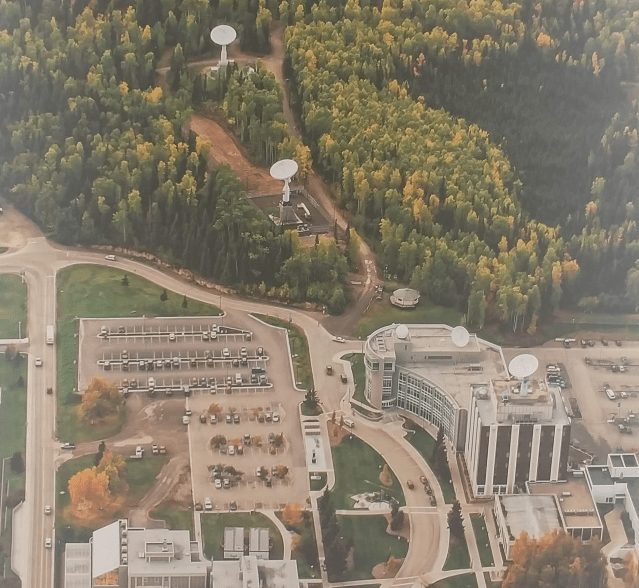
Dr. Webley explained that their ASF program utilizes those satellite dishes to receive, store and process 40% of NASA’s orbiting polar satellite data. Again, pretty impressive.
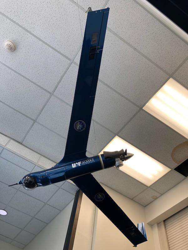
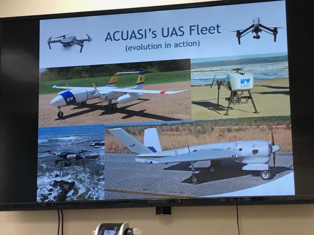
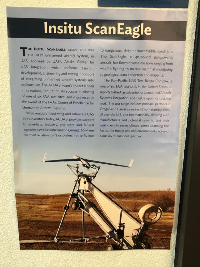
He also went through a history and evolution of their ACUASI program. In the beginning stages of the program they were using the gas powered Boeing ScanEagle which, although quite robust as a catapult-launched fixed-wing UAS, is equally as expensive and cumbersome in the field. Since then the ACUASI has utilized various platforms, from mid-sized commercial quadcopters to larger custom octocopters to even larger fixed winged UAS like the Griffon SeaHunter.
A partial list of past and current ACUASI missions:
- Flying over international shipping lanes to identify current whale locations
- Alaska oil pipeline surveying
- Bridge and road surveying in remote locations
- UAS support for wildfire management
- Survey of salmon populations
- Aerial operations for oil spill response
We look forward to updates from UAF/GI and their UAS IPP partners in future UAS projects. They have certainly shown what leadership in the UAS community looks like.


You must be logged in to post a comment.