by Michael DuFour, Editor at Sky Horse Tech LLC
The Case for UAS Integration
Drones have become a permanent fixture in our world today. Love them or loathe them, they are here to stay. The main obstacle in elevating UAS (Unmanned Aircraft Systems; aka drones) from a backyard toy to a legitimate commercial tool is that of safety. Not just the safety of spectators on the ground but covering everything from cars passing beneath up to the planes flying above. For years the FAA treated hobbyist and commercial drones as two separate worlds where the latter needed to follow stricter guidelines, such as obtaining a Part 107 license and registering drones with the FAA. That solution sufficed, for a while, however the unsafe practice of a few brought the realization that both worlds needed to fall under one umbrella, one where everyone followed the same rules of the road.
With the FAA Reauthorization Act of 2018 the FAA repealed Section 336 which had previously given hobbyist drone pilots much more leniency. Now the hobbyist needs to register their drone with the FAA, follow Part 107 rules when flying in controlled airspace (around airports), notify Air Traffic Control when flying in controlled airspace, always keep the drone within eyesight (VLOS), fly below 400′ Above Ground Level and many other common sense rules.
With this legislation the FAA made progress, going from theoretical Step 8 to Step 9 in a list of 100+ “steps” needed to integrate drones safely into the national airspace (NAS). If Amazon, UPS or your local Pizza Hut are going to be delivering items to your front door by drone there are 90 other steps that need to be worked out, not to mention the necessary advances in technology, before that goal is realized.
Building the UAS Traffic Management System
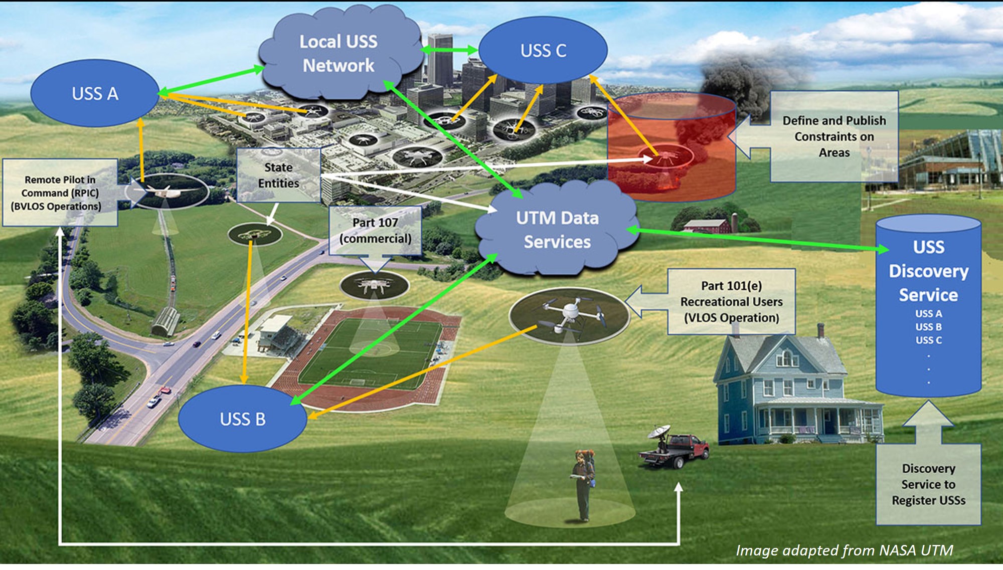
In creating that long checklist, or roadmap, the FAA along with leadership by NASA, developed the UAS Traffic Management (UTM) system in 2015. This system will eventually be integrated into the NAS so private and commercial airplanes will ‘see’ drones and visa-versa. For obvious reasons all parties involved need to be aware of the other, in real-time, in order to avoid a mid-air collision. NASA and the FAA brought in many other governmental departments to make sure all stakeholders were on board and could provide input to the system in development. Currently UTM testing is at TCL 4 (Technology Capability Level 4) where they are performing integration testing for package delivery and news gathering in higher-density urban areas.
Elements of UTM include LAANC (Low Altitude Authorization and Notification Capability) which has recently gone live. This allows commercial as well as hobbyist drone pilots the ability to simply open up an app, enter a few variables such as time of flight, geolocation and max altitude (sub-400′) of their expected flight. Local airports, and anyone in the area, are then able to visualize where drones are flying in that vicinity. This is an important step along the path to full integration of drones into our NAS.
LAANC however requires an element of trust. Trust that the drone pilot will follow the rules and enter their flight plans. Unfortunately, we cannot fully trust that everyone will follow those rules and the safety of the NAS cannot depend on that either.
With that in mind, another step along this path is DAA (Detect and Avoid) technology. DAA allows an autonomous drone to see other aircraft (e.g. drone, airplane, helicopter, hot-air balloon) in their vicinity and change course in order to avoid a collision. Similar to collision avoidance systems in autonomous vehicles today, a drone is a bit more complex in that the detection needs to a) happen much further away (miles instead of meters) and b) needs to monitor a 3-D sphere around the drone instead of a 2-D plane which cars operate on. Some of the advancements in DAA involve radar systems, whether on-board or ground-based. The on-board type of UAS radar/DAA systems are about the size of a tablet and weigh less than two pounds. Other types of DAA include a dedicated ‘smart’ camera that scans the horizon for potential threats. Ground-based DAA systems are produced by outfits like Echodyne and Iris Automation which were used in early August 2019 during the first true BVLOS flight in Alaska. Needless to say, each type of solution has its own pros and cons but the technology is well on its way.
Testing, Testing, IPP
Much of the excitement around drones includes the rapid advancements in technology and how quickly those are brought to market. Outside of the corporate development ecosystem (DJI, Yuneec, Parrot, etc) several of those advancements are being developed and/or tested in our universities and colleges. These institutions of higher learning act as a trusted partner that the FAA can turn to in building the UTM ecosystem. One of those branches of FAA development is the UPP (UTM Pilot Program) which was established in 2017. As noted in the FAA page for UPP “the primary goal for the UPP is to develop, demonstrate, and provide enterprise services, using a cloud service infrastructure, which will support the implementation of initial UTM operations.” This is the construction crew building the UTM highway.
Another similar project is the IPP (Integration Pilot Program) which was created by the US DOT (Department of Transportation) and FAA, also in 2017. The FAA “has brought state, local, and tribal governments together with private sector entities, such as UAS operators or manufacturers, to accelerate safe drone integration.” This integration is vital to having a completely safe national (eventually worldwide) airspace with drones being included as an equally vital player in that environment. Many, if not most, of the commercial drone systems are being developed outside of the US so complete cooperation is not always possible. Here is where partners in the IPP can take a specific drone, thermal camera or software and run it through its paces to see if the level of safety and productivity measures up to the published specs. Sort of a ‘trust but verify’ of our time.
The Northern Flights
One of the 10 IPP Lead Participants is the University of Alaska Fairbanks. This university has a rich history of scientific research, including its flagship Geophysical Institute (GI) which was created by an Act of Congress in 1946. In 2019 this research facility celebrated its 50 year anniversary of developing and using rockets to study the Earth’s electric field in the lower ionosphere. Their researchers have launched more than 1,000 rockets since then. In the years that followed, the GI has studied everything from the vast Alaskan pipeline to the impacts of climate change in the Arctic.
In 2012, UAF created the Alaska Center for Unmanned Aircraft Systems Integration (ACUASI) after realizing the potential uses of UAS. Per the ACUASI website:
It was established under the University of Alaska Fairbanks in the Geophysical Institute where it originated but was given the role of leading all unmanned aircraft programs for the entire system. It was also tasked to pursue opportunities with the FAA such as the FAA test sites. The program originated in 2001, and over the years has expanded in scope, the equipment it operated, and the variety and complexity of research projects it executed. In 2013 ACUASI submitted its proposal to the FAA to become one of the six test sites established by the 2012 FAA Modernization and Reform Act, and in December 2013 the FAA announced that the University had been selected. The Pan-Pacific UAS Test Range Complex reports to ACUASI, but also includes principal partners in Oregon and Hawaii as well as 56 non-state partners located all over the US and internationally. Ranges are located in the three states as well as in Iceland, our key international partner.
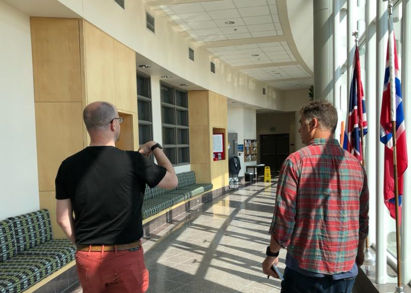
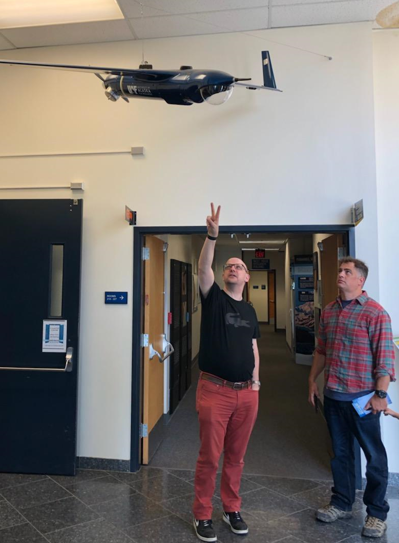
Quite the background. Fortunately, Sky Horse Tech was able to visit the UAF/GI campus to get a sense of their past and future UAS operations. We met with Dr. Peter Webley, Associate Director of Research at ACUASI, who spoke with us and provided a tour around the Geophysical Institute. When driving up to the GI campus it resembles a small NASA facility. There are enormous satellite dishes on top of buildings and among the campus grounds.

Dr. Webley explained that their ASF program utilizes those satellite dishes to receive, store and process 40% of NASA’s orbiting polar satellite data. Again, pretty impressive.
He also went through a history and evolution of their ACUASI program. In the beginning stages of the program they were using the gas powered Boeing ScanEagle which, although quite robust as a catapult-launched fixed-wing UAS, is equally as expensive and cumbersome in the field. Since then the ACUASI has utilized various platforms, from mid-sized commercial quadcopters to larger custom octocopters to even larger fixed winged UAS like the Griffon SeaHunter.
A partial list of past and current ACUASI missions:
- Flying over international shipping lanes to identify current whale locations
- Alaska oil pipeline surveying
- Bridge and road surveying in remote locations
- UAS support for wildfire management
- Survey of salmon populations
- Aerial operations for oil spill response
For those of us not living in Alaska we may never see a UAS operation list that extensive. However, the lessons learned by the ACUASI team can be leveraged by operations in the lower 48 and beyond. Which is really the entire premise behind the national program: for IPP members to implement a workflow, test that workflow and show the FAA that it is ‘safe’ for everyday commercial drone pilots to mimic.
Step(s) Into the Future
While many of us in the UAS community are busy with our daily operations (e.g. surveying, mapping, precision farming, etc) there are other communities out there working behind the scenes to advance the technology. Some of those teams may be corporate-based while others are government (state/federal) or education-based. In order for this technology to advance at a quicker and safer pace we need all of these players to work together. We don’t expect companies to provide open-source code for everything in their portfolio, but there does need to be an element of transparency in their long-term plans so those dependent on their technology can adjust their goals or research accordingly.
With this technology advancing at a rapid pace it is imperative that any UAS operator wishing to remain relative (let alone ahead of the curve) keep up with current developments and future trends. Take a half-hour each day to search for recently published articles and news reports. Follow the major players on social media. Use your UAS to perform a workflow you’ve never tried before even if you may never use it again in the future. By independently testing systems and procedures we then have the ability to provide feedback to others who may benefit.
By actively participating in the UAS community we build a stronger, and ultimately safer, future.
Update: ACUASI was able to successfully survey a 3.87 mile stretch of Alaskan pipeline using DAA technology while also BVLOS. This is the first waiver approved by the FAA for DAA and BVLOS without the use of a visual observer. Progress.
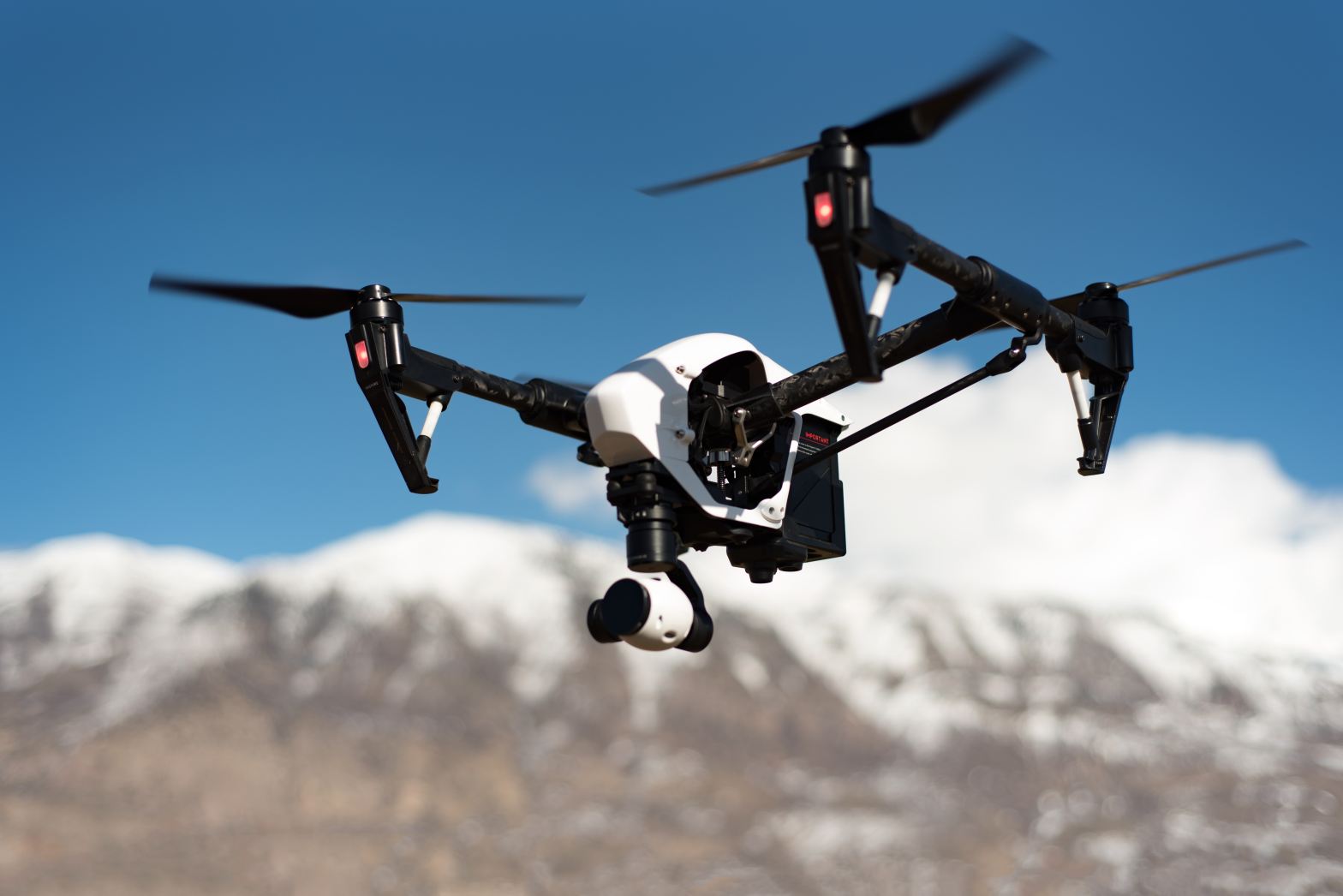
Feature drone image courtesy Mitch Nielsen (@mitchnielsen) at Unsplash.
